


Lakeland Voting District, Washington County, Minnesota
About
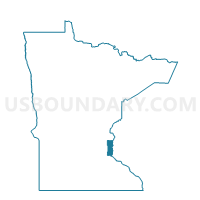
Outline

Summary
| Unique Area Identifier | 604839 |
| Name | Lakeland Voting District |
| County | Washington County |
| State | Minnesota |
| Area (square miles) | 2.93 |
| Land Area (square miles) | 2.07 |
| Water Area (square miles) | 0.86 |
| % of Land Area | 70.78 |
| % of Water Area | 29.22 |
| Latitude of the Internal Point | 44.96544080 |
| Longtitude of the Internal Point | -92.77262710 |
Maps


Graphs
Select a template below for downloading or customizing gragh for Lakeland Voting District, Washington County, Minnesota


Neighbors
Neighoring Voting District (by Name) Neighboring Voting District on the Map
- Afton W-4 P-1, Washington County, MN
- Hudson - C 11 Voting District, St. Croix County, WI
- Hudson - C 3 Voting District, St. Croix County, WI
- Lake St. Croix Beach Voting District, Washington County, MN
- Lakeland Shores Voting District, Washington County, MN
- TROY - T 4 Voting District, St. Croix County, WI
- West Lakeland Twp. Voting District, Washington County, MN
Top 10 Neighboring County Subdivision (by Population) Neighboring County Subdivision on the Map
- Hudson city, St. Croix County, WI (12,719)
- Troy town, St. Croix County, WI (4,705)
- West Lakeland township, Washington County, MN (4,046)
- Afton city, Washington County, MN (2,886)
- Lakeland city, Washington County, MN (1,796)
- Lake St. Croix Beach city, Washington County, MN (1,051)
- Lakeland Shores city, Washington County, MN (311)
Top 10 Neighboring Place (by Population) Neighboring Place on the Map
- Hudson city, WI (12,719)
- Afton city, MN (2,886)
- Lakeland city, MN (1,796)
- Lake St. Croix Beach city, MN (1,051)
- Lakeland Shores city, MN (311)
Top 10 Neighboring Unified School District (by Population) Neighboring Unified School District on the Map
Top 10 Neighboring State Legislative District Lower Chamber (by Population) Neighboring State Legislative District Lower Chamber on the Map
- Assembly District 30, WI (66,575)
- State House District 56A, MN (41,423)
- State House District 57B, MN (41,159)
Top 10 Neighboring State Legislative District Upper Chamber (by Population) Neighboring State Legislative District Upper Chamber on the Map
- State Senate District 10, WI (192,662)
- State Senate District 56, MN (91,226)
- State Senate District 57, MN (81,647)
Top 10 Neighboring 111th Congressional District (by Population) Neighboring 111th Congressional District on the Map
Top 10 Neighboring Census Tract (by Population) Neighboring Census Tract on the Map
- Census Tract 1209.03, St. Croix County, WI (8,609)
- Census Tract 707.01, Washington County, MN (6,580)
- Census Tract 711.02, Washington County, MN (4,630)
- Census Tract 711.01, Washington County, MN (3,526)
- Census Tract 1201, St. Croix County, WI (2,033)